
Every summer when I was a teenage I used to go on backpacking trips through the Sierra Nevadas. One time in Kings Canyon National Park I was forced to learn how to read a topographic map because I had gotten ahead of the group I was with. Learning how to read the contours, observe landforms and spot waterways was a revelation when I saw everything represented on the map was there in the real world. Every map I came across from that point on made sense to me; it also started by love affair with maps, and eventually lead me to study Geography in College.
It seemed only natural for me to then begin collecting antique maps and prints. While these antique maps hang on my walls in my home, they are still pieces of art, technical craft and history that are meant to be shared with as many people as possible.
I originally picked up this piece at Schein & Schein in San Francisco. At the shop I was told for a first time collector it is best to pick a specific region/country. Because I had just moved back to the United States from China, I figured antique Chinese maps were the best place to start.
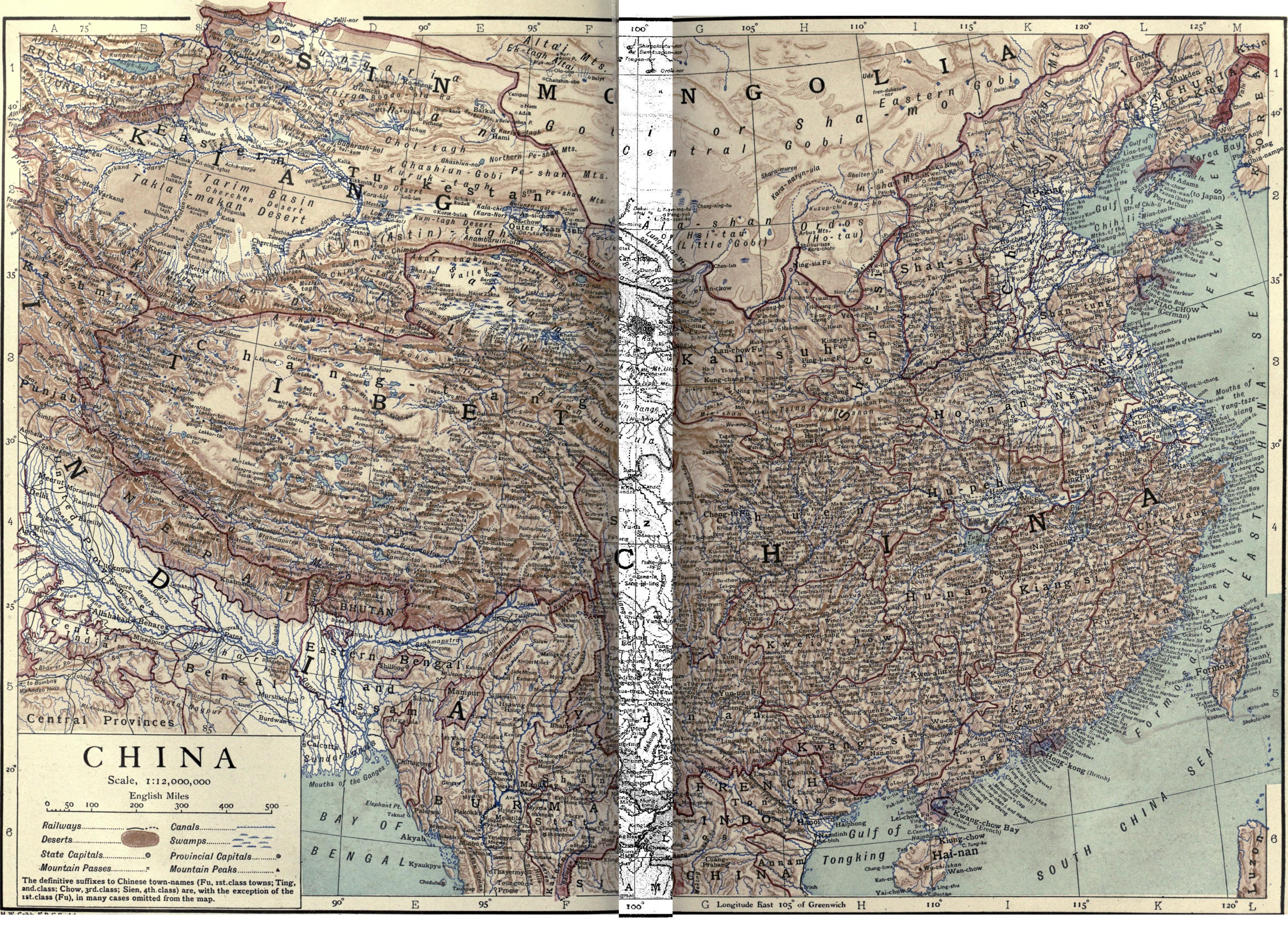
I was told that the map was originally a travel map by H.W. Cribb, a British cartographer (that I’m able to find little information about), and printed by Emery Walker, a knighted British engraver, printer, and businessman. It’s in color, on thin stock paper printed in 1910.
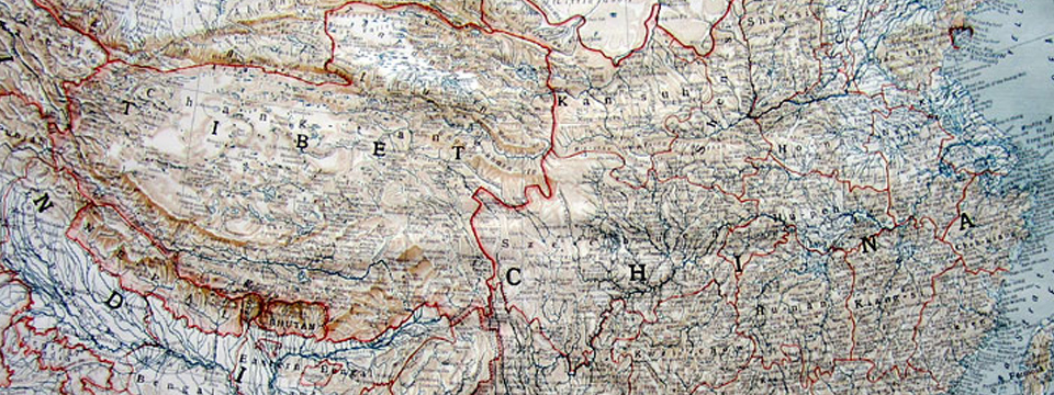
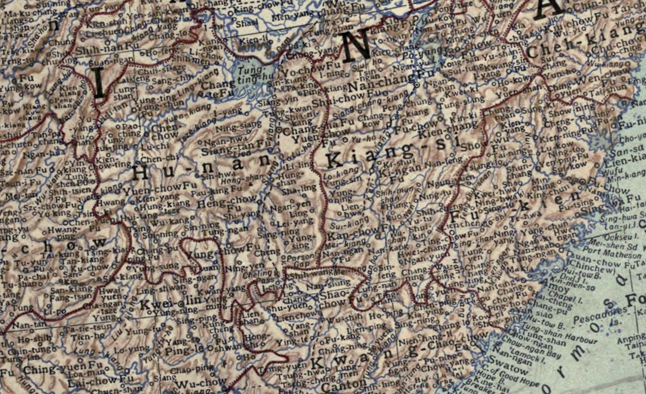
The most peculiar of this map, which is what drew my attention, is the sheer number of Chinese towns and villages places on the map. There are attempts to show topography like deserts, swamps, rivers and canals, but they are completely overshadowed by the thousands of referenced enclaves, towns, villages and cities. As someone who lived in China, the way the whole of the country is confoundingly squeezed in a tight space, but not always given credit for its vastness or importance, still resonated with me. Although this map was made during China’s self-declared Century of Humiliation, it still shows some Orientalist grandeur that fit with the time.
After doing some research, I was able to get some more information as to (one of) the origins of this map. The only thing Google was able to I was told at the map shop that this was likely a pull-out in a travel guide. My copy has creases from being folded for a very long time, but looks to be cut out of a book, due to its unique dimensions.
I was able to find the same map, or a variation of the map (it’s hard to tell), was used in the Volume XI in the Encyclopædia Britannica Eleventh Edition (printed in 1911) for the entry on China. The scan of the map (first image above) that’s accompanies the encyclopedia entry appears to have been scanned while bound directly to the spine of the book. However, I’m not able to find evidence on the paper that it was bound directly the the encyclopedia.
Overall, I’m very happy with my first antique map purchase. It’s unique, has a story and is able to give a small impression of my time in China, even if it is 105 years old.

I have a couple dozen Emery Walker and Encyclopedia Brit. maps, 1910 ish. All in great shape, they came out of old books 30 years ago. Would you be interested in any? US, states, North America and the world…
bye for now,
Craig