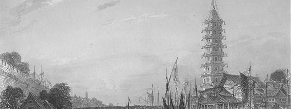
On the same trip that I bought my 1910 HW Cribb map of China, I also picked up an antique print some 70 years older. While it’s not a map, “The Bridge of Nanking” by Thomas Allom, a 19th Century British architect, still represents a place in a specific period of time. The print shows daily life on the outskirts of the ancient wall of Nanjing, Jiangsu, China along the Qinhuai River. This ornate print shows the ancient city wall, lively commercial activity in the morning and a pagoda prominently displayed the right-hand side.
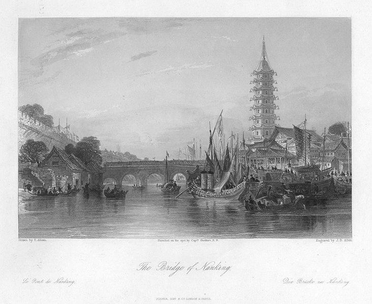
The pagoda is none other than the Porcelain Pagoda (南京陶塔), the most famous structure in the region for several hundreds years and one of the Seven Wonders of the Medieval World. The Porcelain Pagoda, which was destroyed in the 1850s during the Taiping Rebellion, was a beacon of the city’s strength as a merchant hub near the Yangtze. More recently in 2010, a wealthy local business pledged millions of renminbi to rebuild the pagoda to get back some of the city’s glory.
“The Bridge of Nanking” appears to be a page taken out of Allom’s book “China Illustrated” (printed in several volumes between 1843 to 1847). The print is actually based on a sketch made on location by Captain Stoddart of the British Royal Navy, who was responsible for many of the sketches depicted in the book. Allom, who may have never visited China, based his work on the work of those who were there (like Capt. Stoddart).
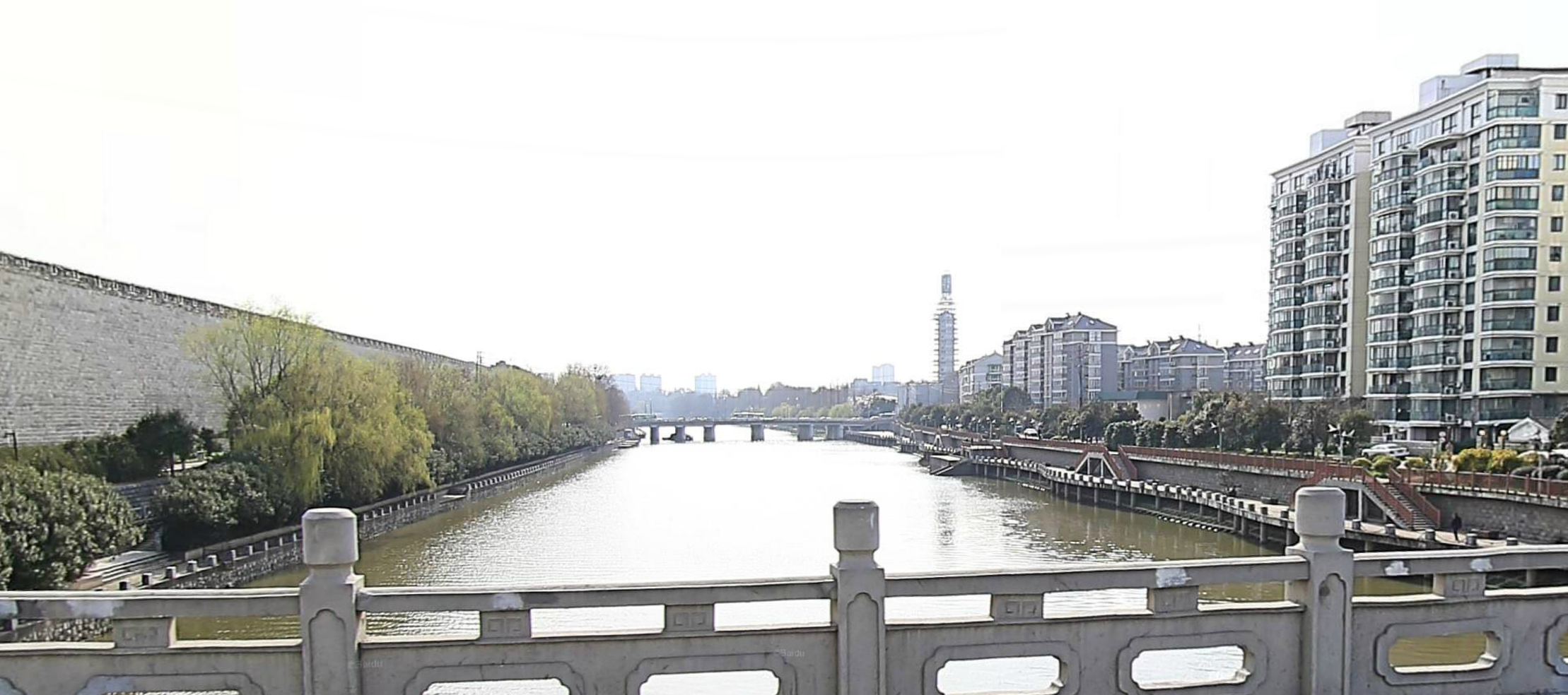
Despite the pagoda’s destruction in the 1850s, the exact location of this view of Nanjing life is not left to history. You can see a similar perspective of the pagoda’s reconstruction (on its original site) from the YinMa Bridge (饮马桥, which leads to Zhanggan Gate,长干门, on the southern side of the city wall). Or, you can see it virtually from Baidu Ditu:
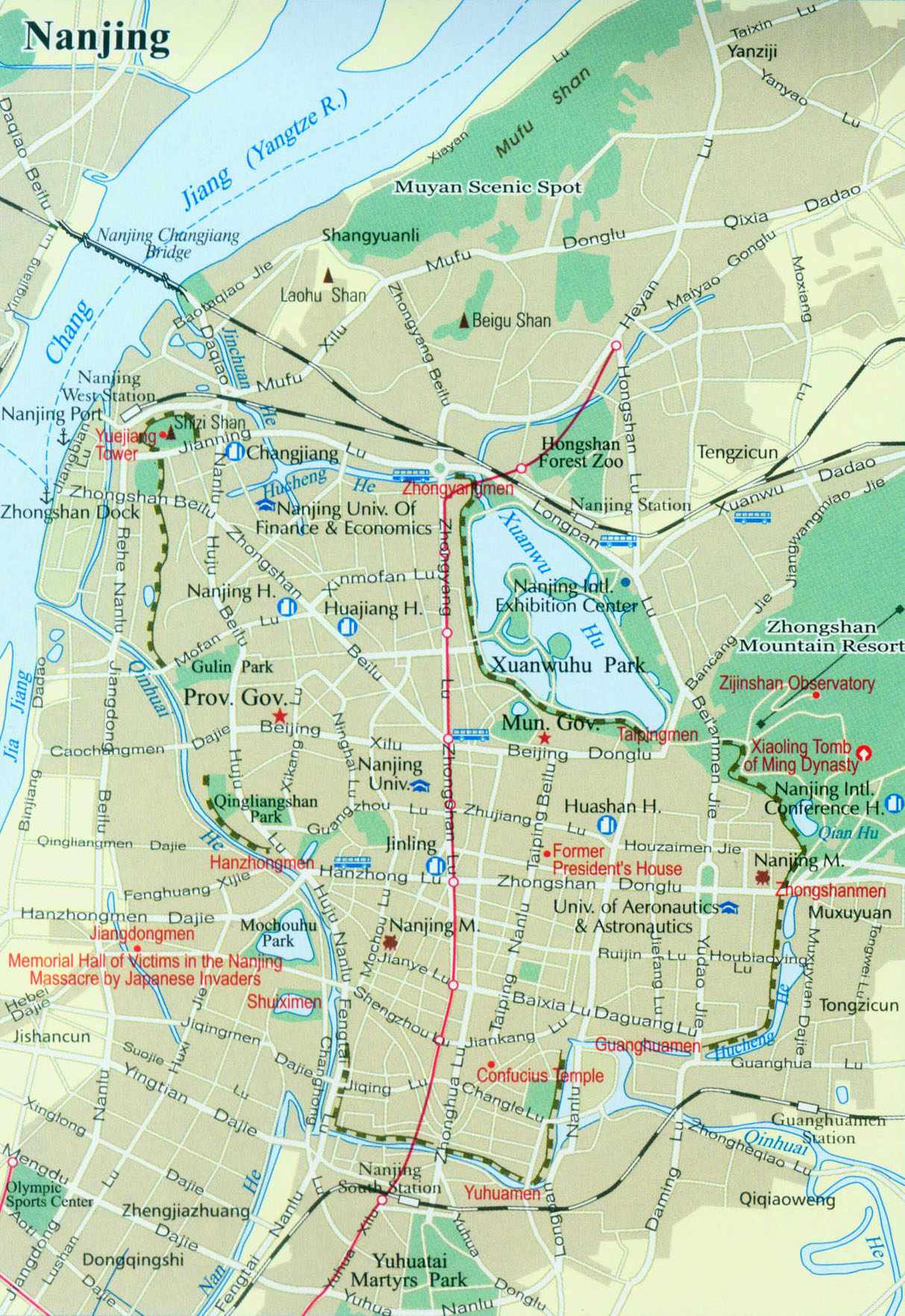
Looking at other maps of the region, the titular bridge is most likely Zhanggan Bridge (长干门桥), which leads directly to Zhonghua Gate (中华门), an entrance and defensive complex of the old Nanjing city wall. I was able to discern the location by looking at some travels map of Nanjing over at China Mike and cross checking the sun rising on the river:
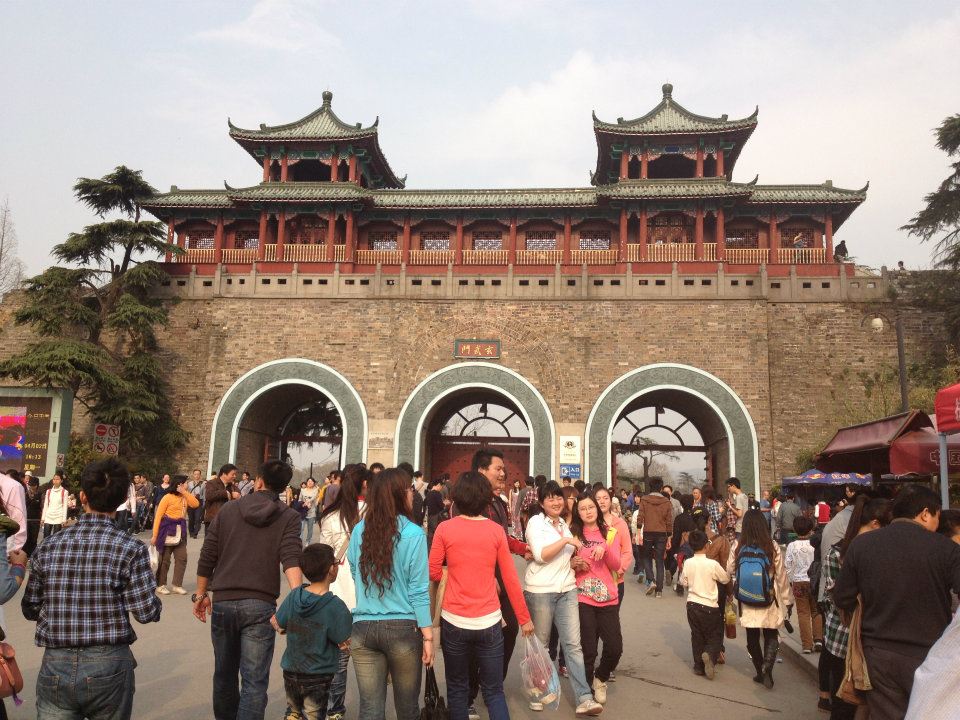
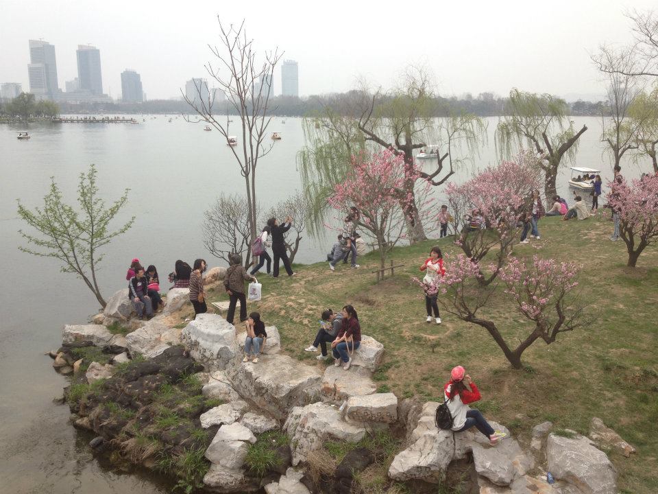
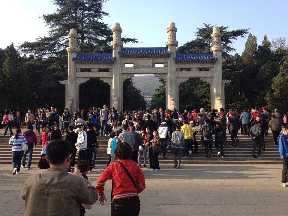
Fond memories from a Qingming Festival trip to Nanjing during my time living in China is one of the reasons I chose to purchase this antique print. After wandering around the city center near the walls, walking through the Xuanwuhu Gate in the north of the city, hiking Zhongshan, exploring the Ming tombs and sprinting to beat the closing gate at the Sun Yat-Sen memorial, I wanted a reminder of my time there. While my trip didn’t offer a chance to see the reconstruction of the Porcelain Pagoda, I was still able to come away with some great memories: